I thought i will never come back to this blog, but when i did a long day hike to enchantment lakes, i decided to blog this experience, for this is definitely a once in a lifetime trip for me.
Enchantment lakes is one of the most spectacular hiking/backpacking destinations in the whole of USA. The forest department allows only 60 permits per day for camping, but there is no such limit for day hiking.
Wiki link here
The biggest challenge for the day hike is the distance and the difficulty of the hike. There are 2 routes to the enchantments. A round trip from either way would be 24 miles. Most people [including us] use 2 cars parked at the two possible route starting places, and do a 20 mile one way trip. [From colchuck lake to snow lake trail heads].
With this idea, 4 people [Me, Nitin, Vivek and Rahul] planned to do this hike in one day.
We carried a lot of food, water and cold weather equipments. I was carrying an ice axe [mostly because i had it, and Vivek had got trekking poles]. So we had a reasonably heavy hiking bags around 20-25 pounds.
We started around 2 AM from our house, and started driving towards the snow lake trailhead in 2 different cars. Having the first car parked there, we went to the colchuck lake trailhead and park
 ed the second car there, and started the hike around 5 AM. It was kind of dark at that time.
[photo on left taken around 5:15 AM when we started the hike. Vivek, Me and Rahul at colchuck lake trailhead]
We made a good start, and moved quickly to colchuck lake which is around 4.5 miles and 2200 ft elevation gain. The morning was cool, and without much sweat, we quickly reached colchuck lake around 7:20 AM. I have been to colchuck lake twice before, but this was the first time i was seeing a reflection of the lake. The early morning stillness showed colchuck lake in all its glory.


[At left is colchuck lake around 7:30 AM in the morning with awesome reflections].
[At right, i am posing in front of the reflections :)]

 [At left in the picture is Aasgard pass. At right below is Nitin, me and Vivek en route Aasgard pass. ]
The upper basin was full of snow, rocks, granite, ice and frozen lakes. We slowly made our way through the basin. Route finding was difficult from here on. Boot tracks of previous hikers helped many times. The next big lake we saw was called "crystal lake". This lake could be seen down below covered in ice, and looked beautiful.

more difficult from now on. For the next 1- 1:30 hours, we tried finding some way even though we knew the general route using the map. But we took the wrong route where there is lot of snow, rock etc, and gave ourselves a hard time. Around 3:00 PM, we finally found the route and talked to some other hikers [who were very few at this place] for the correct route. Then we started making our way around "Inspiration" and "perfection" lakes, crossed "leprachaun" lake and finally lake "Vivaine" [All lakes looked equally good, and these were only partially frozen due to slightly lower elevation around 6700ft].
[At left below is Vivek, Rahul and Nitin trying to see how to get down. At backdrop is perfection lake].
At right below is Lake Vivaine. [Lot ot larch trees which will turn glorious yellow during fall]

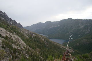
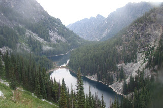
We had now hiked around 10 miles and it was around 4 PM now. Lake Vivaine was the last enchantment lake we were to see and this was in the lower basin. From here, we were to reach the snow lakes which is around 4 miles. The next 2 miles was over very rocky section with route very hard to find. Luckily, a family of hikers [who seemed very fresh and who were doing the gruelling day hike like us] showed us the right route. The descent started, and it was painful over the rocks. After 2 hours, we reached the upper snow lakes. Before the descent from lake vivaine, we could see the upper and snow lakes from there. [See pic below]
Around 6 Pm, we were at snow lakes [upper snow lake]. The trail was to now go around the snow lakes, cross a dam between upper and lower snow lakes. The trail around snow lake itself was around 1.5 miles and took us around 45 mins. We decided to take some rest and had some snacks. A lot of mosquitoes and bugs troubled us. Bug spray did not help much. After some rest and snacks, we started back around 7:30 PM. We still had around 6.5 miles left to complete.
The descent from snow lake was the toughest part. We had around 4200 ft elevation to lose. With tired legs, they look like even more. Around 8:15 PM, we reached Nada lake.
[Left: Nada lake]
From Nada lake, it was still 5.5 miles left. Around 9 PM, it got dark, we started using our headlamps. Slowly we started going down. Around 10:30 PM, we decided to take a quick 10 minute break. Around 10:50 PM, we were able to see the road, and we knew we were around 1.5 miles from the destination. Around this time, we saw a mountain goat on the trail, which was nice.
Then finally, around 11:45 PM, we reached the snow lake trailhead where we had the first car parked. We all got into the car, and drove towards colchuck lake to pick up the second car. Around 12:20 AM [sunday], the 2 cars left colchuck lake, and we drove towards our home. It was 3 Am when we reached home. The drive was one of the toughest in my life. I pulled over the car 3 times [At coles corner, stevens pass and skykomish] to take some quick rest to avoid sleeping. I even did well to avoid a deer when driving back ;)
It was a long trip but well worth it. Around 20-21 miles in one day and some night :)
I will probably return there for fall when all the larches turn yellow. A few pics of the basin below before signing off.
[complete collection :http://picasaweb.google.com/krraghuram/EnchantmentLakes#]


